B-Walking: Sleights Swing-Along
We often think of the North York Moors as our 'home territory' in relation to our walking activities. Today's B-walk took us through the heart of our homeland! Starting just south of Hawsker, we 'circled' in a clockwise direction to Biller Howe and then headed north to Littlebeck and Ugglebarnby and then finished in Sleights.
We set off on today's expedition at about 11.00 am. There were 13 people in the group: JBl, PB, PaB, MC, WF, JF. CL, JL, JM, MM, CR, ER and MW. PB led the walk.
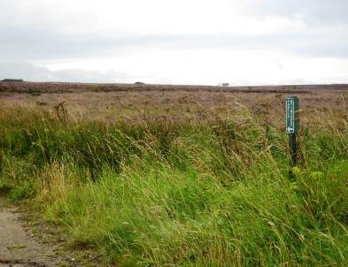
From the drop-off point on the A171 road {NZ 925 052} (see the picture below), we followed a good track in a south-easterly direction across the moorland to reach a minor road at Brow Top {NZ 930 046}.
As we walked south from the road were some good views of the sea and coastland surrounding Robin Hood’s Bay. At {NZ 932 044} we made a steep descent to Fyling Hall {NZ 937 043} and then ‘picked up’ a good farm track on our right. This took us up hill, in a south-westerly direction, through High Park Wood and along the northern edge of Oak Wood to reach Ramsdale Beck. We saw a wonderful example of a water-wheel at the old mill near Ramsdale Mill Farm {NZ 926 035}.

Now taking a southerly bearing, we skirted pass St Ives Farm {NZ 924 027} (on our right) and crossed a number of fields in order to reach a minor road at {NZ 929 018}. Turning right, we followed this in a south-westerly direction to cross the A171 road at {NZ 923 014} in order to reach Pond Farm {NZ 922 012}. We continued along the farm track for about 435 yards to {NZ 919 009}. At this point, we turned to a northerly bearing and went along Biller Howe Dale to reach Ling Hill Plantation {NZ 915 017} - where we took a westerly path. We used this in order to reach the eastern edge of Newton House Plantation {NZ 899 017}. Turning right, we now followed a northerly track (Robin Hood’s Bay Road) to arrive at John Cross {NZ 900 027} - see the following picture.

On leaving the locality of the old cross, we dropped down in a westerly direction to the car park at May Beck {NZ 892 024} where we stopped for an ice-cream. We then had a pleasant stroll through the woods to reach Midge Hall and Falling Foss {NZ 888 035}. This was followed by a gentle climb up to Newton Farm {NZ 0889 039}. We continued our up-hill trek in order to get to Newton House Lodge {NZ 890 042}. From here we took a path on our left that led us, via Thorn Hill {NZ 887 046}, to a minor road (Lousy Hill Lane) at {NZ 886 050}. Turning left, we then followed this road downhill towards Littlebeck.
Just before Littlebeck, at the road junction near the village hall {NZ 880 051}, we turned right and took the uphill road to reach a path on our left at {NZ 881 052}. We followed this in a north-westerly direction towards Busco Gill {NZ 877 059} where we had some difficulty finding the ‘official’ right-of-way1 across the gill. However, we did manage to find a waymarked stile in the fence after hacking our way through the gorse bushes using a pair of secateurs. Once we were into the wood, we made a steep descent to the gill (and the waymark that was located there) and an equally steep ascent up the north side to reach the waymarked stile through which we exited the wood.
After emerging from the wood, we made our way across the fields to a point {NZ 879 065} on a minor road just to the west of Dean Hall2 {NZ 883 064}. We then used Tom Bell Lane in order to get to a minor road at Low Farm {NZ 878 072} near to the small village of Ugglebarnby. As we approached the farm, there were some good views of the church up on the hillside to our right.
On reaching the road that runs from Ugglebarnby to Iburndale, we turned left and went downhill for about 200 yards to reach a public footpath on our right {NZ 877 073}. Just after taking this north-westerly path, I made a navigational error (see here for details). After recovering from this, we made a straightforward downhill trek to Iburndale Beck which we crossed using a footbridge at {NZ 870 077}. We followed the beck in a northerly direction to arrive at the railway station in Sleights {NZ 868 081}. This was just a stone’s throw away from the Salmon Leap Inn (see picture below) where our coach should have been waiting to take us home. Unfortunately, the pick-up location had been moved uphill to {NZ 867 079}!

We had another great expedition today. As JL would say: "It was an adventure"! Use the buttons below in order to see what we did, how we did and pictures of some of the wonderful sights that we saw.
Notes:
1 Busco Gill Problem
During my pre-walk check for this expedition, I experienced great difficulty when trying to find the ‘official’ path across Busco Gill - as documented on the Ordnance Survey OL-27 map. Instead, I had to use a very muddy, gated cow-track further down the hill. There seemed to be a distinct lack of waymarks on the south-side of the gill and no stile (that I could find) in order to get over the boundary fence on the this side of the gill. By back-tracking from a North York Moors (NYM) marker at {NZ 878 061}, I did find what appeared to be a broken style on the north side of the gill. However, as I was to find out later, this was not the waymarked NYM stile. I reported my findings to the NYM Parks Authority on 14th August 2009.
2 Path re-routing near Dean Hall
Since my 1993 Edition of OS Sheet 27, there has been considerable path re-routing in relation to the public right-of-way between Busco Gill and Tom Bell Lane. My latest 2008 Edition of Sheet 27 (and my Memory-Map 1:25000 scale digital maps) show the extent of the path diversions. The path from Busco Gill to Dean Hall (as shown on my 1:50000 scale 2002 Edition of Anquet digital maps for the area) no longer goes across the fields to Dean Hall. Instead, the path now goes directly north to Tom Bell Lane - as shown on the more up-to-date maps. Click this link in order to see a comparison of the old and new footpath arrangements.
Labels: B-Walking: Sleights Swing-Along
posted by philbee @ 14:46
0 Comments
![]()


0 Comments:
Post a Comment
Subscribe to Post Comments [Atom]
<< Home