A-Walking: Wolsingham Wobbler
Our SRC A-walk expedition today took us back again into the Weardale area of County Durham. Today's activity involved a trek from the village of Wolsingham {NZ 076 372} in a northerly direction, via Tunstall Reservoir and Smiddy Shaw Reservoir, in order to reach our final destination in the village of Edmundbyers {NZ 016 500}.
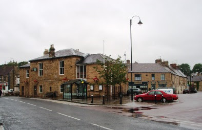
We set off from our drop-off point on the A689 (just to the east of the village centre - see the picture below) at about 10.45 am. There were 5 people in the group: JB, PB, RB, MC and JP. PB led the walk.

Leaving the A689 road, we followed Lydgate Lane from {NZ 080 372} in a northerly direction to meet the B6297 road at {NZ 079 378}. Turning right, we went uphill to {NZ 080 380} where we took another minor road on our left (Thistlewood Lane) in order to reach Thistlewood Farm {NZ 078 389}. From here we climbed up to the trig point on Wolsingham North Moor {NZ 077 404}. As we headed north, there were some good views of the radio masts at Rogerly High Plantation and Collier Law to the west. After passing the trig point, we stayed on the high ground for another 570 yards and then took a westerly down-hill path on our left that took us to the dam at the south-eastern end of Tunstall Reservoir {NZ 066 408}.
We crossed the dam and then followed a minor road along the western edge of the reservoir to arrive at a bridge at {NZ 069 418} near Tunstall House Farm. After crossing the bridge, we had a good climb in an easterly direction in order to get to the dismantled railway line at {NZ 078 420}. From here we took a north-westerly bearing and headed across Salter's Ridge and onwards to reach Drypry. By now, the rain had set in and we decided that it might be wise to take our lunch stop under the cover in the trees in the woods near to the disused quarries at {NZ 067 434}.
After a pleasant lunch stop under the trees, we continued our north-westerly trek along the edge of the forest - following the old Ministry of Defence boundary fence. We turned right at {NZ 053 443} and again at {NZ 053 446} and made our way across the fields to the dismantled railway line at Waskerley Farm {NZ 051 453}. From here we followed the Waskerley Way to a north-easterly track at {NZ 043 454}. We used this to navigate a route to Smiddy Shaw Reservoir {NZ 046 460} where we joined another track on our left. We used this track, and the dam wall itself, to 'half-circle' the reservoir in a clockwise direction to reach {NZ 044 464}. At this point we descended from the dam wall using a flight of steps.
From the reservoir we took a north-westerly bearing and headed for Lamb Shield Farm {NZ 024 489}. This involved trekking across Muggleswick Common and, in so doing, we had to cross both Hishope Burn {NZ 039 473} and Coalgate Burn {NZ 027 486}. Continuing on a westerly bearing, we crossed the B6278 road at {NZ 008 488} in order to pick up a track that took us down to a river-bridge at {NZ 004 490} near Swandale Cottage. We now took a track along Limerick Edge that went in a north-easterly direction up the western bank of Burnhope Burn in the direction of Edmundbyers. We joined the B6278 road at {NZ 013 497} and followed this to our final destination in Edmundbyers {NZ 016 500} - see the picture below.

Sadly, the local hostelry - the Punch Bowl - was closed for refurbishment. This meant that we could not get any refreshments at the end of our walks. Nevertheless, and despite the somewhat poor weather conditions, we had a great day.
Use the buttons below to see where we went, how we did and look at some the photos that we took.
Labels: A-Walking: Wolsingham Wobbler


0 Comments:
Post a Comment
Subscribe to Post Comments [Atom]
<< Home