Tuesday 27 October 2009

A-Walking: Saltburn Swinger

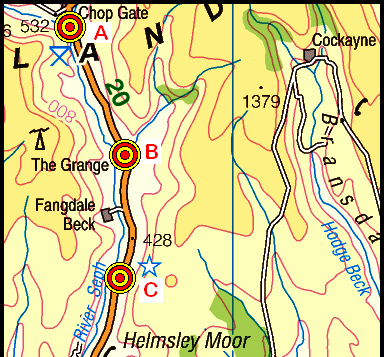
Following last week's 'inland' walks, today's events took place in the eastern coastal region of the North York Moors. Our expedition today started at the Gerrick junction (and car park) on the A171 road {NZ 705 119}. We travelled from here along Gerrick Lane (see picture below) to Saltburn via High Waupley, Roxby Woods, Roxby Park, Boulby and the Cleveland Way (CW).

Gerrick Lane
We set off from our drop-off point at about 10.55 am. There were 8 people in the group: JB, JPB, PB, RB, MC, JH, KF and SR. JB led the walk.

From the locality of the A171 road, we walked in a northerly direction along Gerrick Lane. As we went down the lane we passed the old derelict house at {NZ 705 126} (see here). At Low Farm {NZ 706 129} we turned onto an easterly bearing and made our way (via Stubdale Farm {NZ 713 127} and Lane Head Farm {NZ 716 134}) to the B1366 road at {NZ 719 135}.

Continuing in an easterly direction we now trekked over Waupley Moor to a point just west of Low Waupley {NZ 725 136}. After negotiating a somewhat dilapidated stile1, our route now took us north to High Waupley {NZ 727 144} - passing the trig point on our right2. We continued through the farm, subsequently making our way to a path junction at {NZ 729 153}. Turning right, we followed the PRW3 to meet a minor road (Grinkle Lane) at {NZ 737 150} where we turned left.

Now walking in a northerly direction,we followed the road to find a footpath on our right {NZ 740 157}. This took us through Grinkle Park Farm and Spring House Cottages {NZ 745 160}. From here we descended in an easterly direction into a steep wooded valley. We crossed Easington Beck using a footbridge at {NZ 748 159} and then climbed up to a minor road (Ridge Lane) at {NZ 749 159}. We used the path on the immediately opposite side of the road (see here) in order to make our way to the footbridge over Roxby Beck {NZ 751 158} and then continued across the fields to a minor road at {NZ 762 161} near Home Farm - just to the north-west of Roxby.

Turning left, we went downhill (pass Manor House Farm). Just after the church (see picture below) we turned left onto a northerly path. This took us down into Roxby Woods (again). We used the footbridge at {NZ 761 172} (see here) to cross Roxby Beck (again). Just after crossing the stream, we stopped for a very welcome lunch stop - for which, we sat on a conveniently positioned fallen tree trunk overlooking the beck.

Roxby Church
After lunch we continued on our easterly bearing, following a delightful path through the woods4, in order to reach Ridge Lane at {NZ 769 179}. Turning right, we followed the road for about 190 yards. We now turned left over a bridge/ford and had a good climb up to the A174 road at {NZ 769 185}. From here we made our way to Redhouse Nab where we joined the Cleveland Way at {NZ 770 187}.

We now turned onto a north-westerly bearing and followed the route of the CW to Boulby {NZ 760 191} - after which we had a very good climb up Rockhole Hill. Once we were up on the high ground, we had a 'good run' along the coast to Skinningrove {NZ 714 200}. There were some tremendous views of the eastern coastline during our trek along the CW. As we were making our descent into Skinningrove, we could see the B-party just leaving the village after their tea stop. As the benches overlooking the sea were now vacant, we decided to take advantage of them and have our tea stop here.

After our short tea break, we made our way pass the old jetty (on our right) to Cattersty Sands. After negotiating the sand-dunes, we had another good climb up onto Cattersty Cliff {NZ 706 206}. Following a short 'catch-up' stop, we continued (at a goodly pace)along the CW - passing Richard Farrington's iron sculptures near Hunt Cliff {NZ 691 218} (see here) as we went. By the time we reached the Ship Inn at Saltburn (see the picture below) we had caught up with the tail-end of the B-party. However, at this point, we decided to have another catch-up stop.

Saltburn
The final part of our route took us across the sea front at Saltburn (over Skelton Beck) to {NZ 668 216} where we turned onto a south-westerly bearing. After another good climb we arrived at the bandstand, near to which, our coach was faithfully waiting to take us home.

Although we had slightly over-shot our 6-hour time window for the walk, we had a brilliant day. Even the head-on strong winds we experienced coming up the CW were enjoyable - they added a level of unpredictability to the trip (not knowing where we would be blown next as we swung about in the wind).

Many thanks to JB for facilitating today's adventure - and, of course, for his expert level of leadership.

Use the buttons below to see where we went, how we did and some photographs of the excellent things that we saw.


Notes

1 The stile at {NZ 725 136} was in a very poor state of repair, so much so, I decided to report this to the North York Moors Parks Authority (NYMPA).

2 The trig point at High Waupley was surrounded by a barbed-wire boundary fence and was really a little too far off to photograph without a telephoto lens. However, here are two photographs: Photo-1 and Photo-2.

3 The path section running from {NZ 729 153} to {NZ 732 152} is shown on the OL 27 map as running along the south-side of the boundary fence. In actual fact, it appeared to us that the path lay on the northern side of the fence. Again, I took this matter up with the NYMPA.

4 As we went through this part of the wood, JB took us to see an old tramway tunnel dating back to the ironstone era - for further details see here and here.


Labels:

Monday 26 October 2009

SRC Annual General Meeting

On Monday, 2nd November, Stockton Rambling Club will hold its Annual General meeting. The venue for this event is the Linthorpe Community Centre {NZ 491 186} - see the following map.

Map of the Linthorpe Community Centre area
Crown Copyright (2009). All rights reserved. Licence No. 100046831.
Produced using Anquet Maps.

Please meet at 7.30 pm for 8.00 pm.


Labels:

Sunday 25 October 2009

Sunday Walking to Richmond

On Sunday, 1st November, the Stockton Rambling Club will have three walks in the Swaledale area of North Yorkshire. All walks will finish in Richmond {NZ 169 011} - see the following map.

Map of the Scorton-Richmond area
Crown Copyright (2009). All rights reserved. Licence No. 100046831.
Produced using Anquet Maps.

The A-walk will start at Catterick Bridge {SE 227 994} and will take in Skeeby, Gilling West and Willance's Leap.

The B-walk will also commence at Catterick Bridge and will visit Skeeby, Gilling west and Aske Hall.

The C-walk will set off from Scorton {NZ 251 001} and will pass through Catterick Bridge, Colbeck Hall and Holly House.

This is a Route 2 coach pick up and is also an early start (Billingham: 9.00 am, Acklam: 9.15 am and Stockton: 9.30 am).


Labels:

Wednesday 21 October 2009

Mid-Week Walking from Hawnby

On Thursday, 29th October, Stockton Rambling Club have a mid-week walk in the Hawnby area of the North York Moors. Please meet at 10.30 am at the Hawnby Village Hall Car Park {SE 542 894} - see the following map.

Map of the Hawnby area
The walk will not be longer than 10 miles.


Labels:

Tuesday 20 October 2009

A-Walking: Gleefully Greta

Following last Sunday's adventures on the North York Moors, this week's expeditions took place in County Durham. Our trek today took us from the village of Bowes in an easterly direction to Greta Bridge via Howlugill, Spanham, How Tallon, and Barningham.

Within walking circles, the small village of Bowes is well-known for a number of reasons - including its castle (now in ruins) its church and its pub. It is strategically positioned to the south-west of Barnard Castle and offers a useful starting point for exploring the terrain that lies between the A66 road and Swaledale.

We set off from our drop-off point in Bowes {NY 996 135} at about 11.00 am. There were 9 people in the group: PB, KF, CH, JH, MH, LM, WM, JY and PY. PB led the walk.

From Bowes, we headed south along a minor road that took us to Gilmonby Bridge {NY 996 132} (see picture below) where we crossed the River Greta.

Gilmonby Bridge
About 90 yards after the bridge we turned left onto a public footpath that took us in a south-easterly direction towards Howlugill. At {NZ 002 127} we turned right and made for a minor road at {NZ 001 124}. Turning left, we followed this for about 400 yards in order to reach a south-going footpath at Quarry Hill {NZ 004 121}. This took us to Farewell and The Combs.

Continuing on our south-easterly bearing, we crossed Eller Beck using a ford at {NZ 006 110} (see here) and then made our way to Spanham {NZ 015 101} (see here). As we travelled south, there were some good views of Scargill Low Moor (to our left) and Scargill High Moor (to our right). Ahead of us, as we got closer to it, Spanham Scar1 was a very impressive sight (see here).

From Spanham Farm, we headed west to Spanham East Hill as we trekked to {NZ 010 098}. We now turned onto a southerly bearing and made our way pass Scargill Mine (see here and here) towards the western edge of the forest (The Stang) at {NZ 010 089}. Once we were in the forest, we looked for an appropriate spot at which to take a short lunch break.

After a pleasant lunch in the sun, sheltered from the wind by the surrounding trees, we continued our south-easterly trek until we reached a minor road at {NZ 022 074} (see here). As we walked through this area, the extensive deforestation that has been taking place was very apparent (see the picture below). More details on this are available here.

Deforestation
Just after crossing the road we reached the highest point on the walk {1600 feet) at {NZ 023 075}. We now continued our easterly trek across the southern edge of The Stang passing Hope Scar as we went {NZ 033 076}. Since the trees on both sides of our track had been cut down, and we were quite high up, we had some tremendous views of Barnard Castle (to the north) during this section of the walk.

We re-entered a wooded area at {NZ 037 077} and subsequently emerged from the forest at {NZ 042 080}2. From here we made our way to Black Hill Gate {NZ 044 083 } where we were able to enter the access land that lay to the south of us. We now made our way uphill to Hush Head and, continuing on our southerly bearing, arrived at Cocker Hill3 {NZ 044 069} where we had a short tea stop. At 1546 feet, this was the second-highest point on our route. After our tea break we followed the boundary fence (on our right) as we trekked to the trig point on How Tallon {NZ 057 074} (1453 feet). We now changed to a north-easterly bearing and made our way (via Badger Way Stoop {NZ 064 077}) to the village of Barningham {NZ 084 103} - continually losing height as we progressed.

As we approached the village, we half-circled around Barningham Park in an anti-clockwise direction to join the road at {NZ 085 103}. After making our way to the church {NZ 085 104}, we left the village in a westerly direction along Low Lane. At {NZ 082 106} we turned right and made a northerly trek over the fields in order to reach Wilson House {NZ 083 118} where we joined a minor road. We followed this in a northerly direction until we reached {NZ 084 125}. At this point we took a footpath through Mill Wood and across the fields to reach Greta Bridge {NZ 086 132}.

Greta Bridge
During today's expedition we experienced some really tremendous sights: good views from the high ground, the autumnal colours of the trees and the varied moorland hues. Overall, another excellent day!

Use the buttons below to see where we went, how we did and some of the sights we saw.


Notes

1 On my 2002 imprint of the OL 30 map, and on my digital version of it (as provided by Memory-Map), 'Spanham Scar' is actually referred to as 'Spanhan Spar' - see the following map section:

Crown Copyright (2009). All rights reserved. Licence No. 100046831.
Produced using Memory-Map (Version 5).

Fortunately, as can be seen below, in the 2009 imprint of the printed version of OL 30, and within the version that exists on the Ordnance Survey's online Get-a-Map facility, this error has now been corrected.

Crown Copyright (2009). All rights reserved. Licence No. 100046831.
Produced using Ordnance Survey's Get-a-Map facility.

2 At this point I had intended to turn right and make a southerly trek along the edge of the forest (on our right) in order to reach Cocker Hill. However, it was necessary to make a minor Amendment to Route at this point. Click here to see the details of this.

3 Some maps suggest that there is a mast of some type on Cocker Hill. For example, as can be seen in the map section below, the Ordnance Survey's (2009) Get-a-Map facility shows a mast icon on the top of the hill. In fact, there has not been any mast there for many years!

Crown Copyright (2009). All rights reserved. Licence No. 100046831.
Produced usingOrdnance Survey's Get-a-Map facility (October, 2009).


Labels:

Monday 19 October 2009

Sunday Walking to Saltburn

On Sunday, 25th October, the Stockton Rambling Club will have three walks in the Eastern Region of the North York Moors. All walks will finish in Saltburn {NZ 665 215} - see the following map.

Map of the Gerrick-Saltburn area
Crown Copyright (2009). All rights reserved. Licence No. 100046831.
Produced using Anquet Maps.

The A-walk will start at Gerrick Lane {NZ 705 120} and will take in Waupley, Roxby Park and Boulby; it will then follow the Cleveland Way to Saltburn.

The B-walk will commence at Grinkle Lane {NZ 731 125} and will visit Roxby Park and Redhouse Nab; it will then follow the Cleveland Way to Saltburn.

The C-walk will also set off from Grinkle Lane and will pass through Waupley, Handale and Loftus; it will then follow the Cleveland Way to Saltburn.

This is a Route 1 coach pick up and is also an early start (Billingham: 9.00 am, Stockton: 9.15 am and Acklam: 9.30 am).


Labels:

Thursday 15 October 2009

Mid-Week Walking from Sedgefield

On Wednesday, 21st October, Stockton Rambling Club have a mid-week walk in the Sedgefield area of County Durham. Please meet at 10.30 am at Sedgefield Church - see the following map.

Map of the Sedgefield area
The walk will not be longer than 5 miles.
For further details ring 01642-585797.


Labels:

Tuesday 13 October 2009

A-Walking: Hawnby-Helmsley Highlights

Following a goodly weekend walking in the Haworth area of North Yorkshire, the venue of our expeditions this Sunday returned to the North York Moors. Our route today took us from the car park in Chop Gate {SE 559 993} to Helmsley via Hawnby, Oscar Park Farm and Ash Dale.

Our coach was full to capacity today. This meant that there was no room for two of our A-walkers - who were planning to get on the coach at Stokesley. Consequently, they decided to drive to the Chop Gate car park (see the picture below) and join us there.

Village Hall
We set off from our drop-off point in the car park at about 10.30 am. There were 11 people in the group: JB, JPB, PB, RB, CH, JH, MH, JJ, KF, LM and WM. RB led the walk.

After leaving the Village Hall (see the above picture), we had a steep climb in a south-westerly direction in order to reach the high ground near Cock Howe {SE 543 984}. We then turned onto a southerly bearing to pass over Wether Hill as we made our way towards Bilsdale West Moor. As we travelled south, we passed Miley Howe {SE 546 970} (for further details and photograph - see here) and the impressive Bilsdale transmitting station on our left.

Bilsdale transmitter
After passing Meggy Mire {SE 547 963} on our right, our track turned to the left. We continued along this track for a further 275 yards to {SE 551 961} and then turned right onto another good track. Following this in a south-westerly direction, we made our way to Low Thwaites {SE 543 944} (see here). Continuing on our southerly trek across Hawnby Moor, we arrived at Moor Gate {SE 539 917}. At this point, MH and CH left us in order to make their way back to their car at Chop Gate.

From Moor Gate we followed a path in a south-westerly direction that took us along the western side of Hawnby Hill. Just after Hill End House, at {SE 537 909}, we took a path on our left. This took us through a very pleasant wood and brought us out near the inn at Hawnby {SE 543 898}. We stopped here for a short lunch break - making use of the bus shelter for our seating arrangements.

The Inn at Hawnby
Following a somewhat 'idyllic' lunch stop, we made a downhill trek to the village and crossed the River Rye using the road bridge at {SE 543 893}. Just after the bridge we took a footpath (on our left) which took us in a south-easterly direction towards Ristbrow Farm where we joined a minor road at {SE 550 888}. Turning left, we followed the road to Shaken Bridge1 {SE 560 883} where we crossed the River Rye again. We now had two good climbs as we made our way along the road (via Cringle Carr - see photo) to its junction with the B1257 road at {SE 572 870} near Bilsdale Telephone Exchange (see photo).

Turning left, we headed north along the road for about 340 yards until we reached the footpath at the entrance to Oscar Park Farm {SE 572 873}. We followed the FP in a north-easterly direction through the farm and onwards to enter a wood at {SE 578 881}. From here we made an easterly trek through the wood and, after making a steep descent down into a valley bottom, reached our tea stop at {SE 592 880}. The character of the woodland that we walked through is illustrated in the photographs shown here, here and here.

After a short stop, we negotiated a route to a minor road at {SE 598 876}. Turning left, we stayed with the road for about 360 yards in order to reach High Baxton's Farm and an easterly-going footpath at {SE 598 879}. This took us into Ash Dale Plantation at {SE 601 879}. We continued along the path to {SE 604 878} where we turned right and then made a southerly trek through Ash Dale2. We maintained our southerly bearing for about 2.25 miles until we reached {SE 613 845} where we took a path on our right. This took us across the fields in a south-westerly direction towards Helmsley - and the end of the walk at {SE 610 838}.

Arriving in Helmsley
We had another wonderful day today: a great walk, tremendous scenery and weather that improved as the day unfolded. Many thanks fo RB for facilitating our day.

Use the buttons below to see where we went, how we did and some of the sights we saw.


Notes

1 The old bridge was damaged by flash flooding in June 2005. It was subsequently demolished and rebuilt in a 'more modern' style - see Picture 13 in the Photo Gallery. Interestingly, Hawnby Bridge was similarly damaged during this period of flooding.

2 Ash Dale (AD) is one of three parallel walking routes from the north into Helmsley. The other two are Riccal Dale (to the east of AD) and Beck Dale (to the west of AD).


Labels:

Monday 12 October 2009

Sunday Walking to Greta Bridge

On Sunday, 18th October, the Stockton Rambling Club will have three walks in the Barnard Castle area of County Durham. All walks will finish in Greta Bridge {NZ 086 131} - see the following map.

Map of the Bowes to Greta Bridge area
Crown Copyright (2009). All rights reserved. Licence No. 100046831.
Produced using Anquet Maps.

The A-walk will start at Bowes {NY 996 135} and will take in Spanham, The Stang, Mast Hill and How Tallon.

The B-walk will also commence at Bowes and will visit Spanham, The Stang, Scargill and Brignall Banks

The C-walk will set off from Winston {NZ 139 167} and will pass through Whorlton, Abbey Bridge and Mortham Tower.

This is a Route 2 coach pick (Billingham: 9.30 am, Acklam: 9.45 am and Stockton: 10.00 am).


Labels:

Friday 9 October 2009

C-Walking: Ogden Ogler

Today’s walk (Sunday, 4th October) was the second of two walking expeditions undertaken during our weekend at Haworth Youth Hostel. Our route took us from Ogden Water over Ovenden Moor to Leeming Reservoir and then back to the hostel via Oxenhope and Brow Moor.

We used our coach in order to get to the starting point for the walks {SE 070 309}. We set off from our drop-off point on the A629 (near the Causeway Foot Inn) at about 10.00 am. There were eleven people in the group: BB, DB, PB, SB, CG, KaH, DK, PL, JM, JR and PR. PB led the walk.

Ogden Water
From the A629 road we set off in a westerly direction along Ogden Lane in order to reach the Visitors’ Centre at Ogden reservoir. After crossing the dam (see picture above), we followed a good uphill track onto Round Hill - passing Halifax Golf Course on our left. At {SE 048 308} we turned right and crossed Ovenden Moor in a north-easterly direction - passing a very impressive wind farm on our left1 - see the picture below. As we crossed the moor, we passed over an interesting bridge at {SE 049 311} and another at {SE 054 318}. The latter appeared to be an old dam that bridged the valley near a disused quarry. Just after this bridge we found a sunny sheltered (from the wind) spot {SE 052 320} where we took our early-morning coffee break. PL distributed samples of her home-made sloe-gin.

Wind Turbine Farm
After a good break, we continued our trek on a north-westerly direction across Thornton Moor. There were some good views of Thornton Reservoir (on our right) as we made our way to Hambleton Lane. We followed this to {SE 046 334} where we joined the route of the Bronte Way (BW) - which we followed to {SE 041 339}. We now made a slight deviation to the original route2 by making for and following a footpath that would take us around the southern edge of Leeming Reservoir (see the picture below). Because the reservoir was so picturesque, we decided to take our lunch break here at {SE 041 340}.

Leeming Reservoir
Following our lunch stop, we continued our trek along the perimeter path of the reservoir in order to re-join the BW at the dam {SE 037 343}. We now made a steep descent to Back Leeming. Our route now skirted around the eastern side of Oxenhope and passed by Oxenhope railway station3. Just after the station, at {SE 035 356}, we joined the Worth Way (WW). We followed this in a northerly direction until we reached a path junction at {SE 037 362}. At this point we introduced a deviation to the originally planned route4. Instead of continuing along the WW, we took a north-easterly path uphill onto Hebden Road (the A6033). From here we climbed up to a minor road at {SE 040 364} - just to the south of a prominent wind turbine. Following the road for about 130 yards in an easterly direction, we joined the WW (again) and followed this across Brow Moor. At {SE 044 366} (just west of Laveroc Hall Farm) we found a sheltered spot where we had a short tea-stop - PL again distributed small measures of her sloe-gin.

From our tea-stop location we continued along the WW, crossing the B6144 road at {SE 047 369}, and joined the A629 at {SE 047 375}. Turning left, we followed the A629 to its junction with the A6033 at {SE 046 377}. We followed the A6033 in a westerly direction to its junction with the B6142. From here we made our way back to the youth hostel at {SE 039 378}.

In contrast to yesterday’s weather, the conditions today were much calmer. Although we had an occasional shower of rain, there was plenty of sunshine and lots of blue sky.

Use the buttons below to see where we went, how we did and some of the things we saw.


Notes

1 When we were walking on Penistone Hill yesterday, we noticed that none of the wind turbines were working. We thought this was rather ironic - lots of wind and the turbines were not making use of it! However, a conversation with one of the wardens at Ogden Visitors’ Centre revealed the reason why they were not working. Apparently, if the wind speed gets above 65 mph, the turbines are turned off for safety reasons.

2 The original route at this point would have continued along the Bronte Way.

3 Oxenhope railway station is the southern terminus of the Keighley and Worth Valley Railway which is a privately owned railway company that is run by a preservationists' society. Further details of the railway can be found by following this link. At this site there is an interesting timelapse video of an engine driver's view of a trip from Keighley to Oxenhope (in 23 just seconds).

4 At this point the original route would have continued in a northerly direction along the route of the Worth Way (following the course of Bridgehouse Beck) into Haworth.


Labels:

A-Walking: Haworth Howler

The walk today (Saturday) was the first of two expeditions undertaken from Haworth Youth Hostel over the weekend of 3-4 October. Our circular route took us from the hostel up onto Penistone Hill and then back to the hostel via Bronte Bridge, Watersheddles Reservoir, Keighley Moor Reservoir, Newsholme and Mytholmes.

We set off from the Youth Hostel (see the picture below) at about 9.30 am. There were four people in the group: JB, PB, RB and KF. PB led the walk.

Haworth Youth Hostel
Leaving the hostel in a south-westerly direction along Longlands Drive, we turned right onto the B6142 road and went downhill on a south-westerly bearing to reach Haworth Railway Station. From here we climbed up along cobbled streets to the church at {SE 030 372} and then picked a route - via the Balcony {SE 028 370} - up to the trig point on Penistone Hill {SE 024 367}. We then made our way west to a minor road at {SE 017 364} where we joined the Bronte Way (BW). Following this in a westerly direction we passed by Lower Laithe Reservoir on our right and continued to Bronte Bridge {SD 998 358}. We used this to cross over South Dene Beck and then climbed up out of the valley (in a northerly direction) to join the Pennine Way (PW) at {SD 996 363}. We followed this to Rush Isles {SD 996 371} and then continued with it, along the side of Ponden Reservoir (see the picture below), to reach Whitestone Farm. We left the PW just before the farm, at {SD 987 373}, and continued along the BW in a north-westerly direction to cross over the River Worth using a footbridge at {SD 976 377}. Continuing along the side of the beck, we stopped for a short lunch break at {SD 973 379}.

Ponden Reservoir
After our very brief lunch stop we made our way along the valley bottom to the dam at Watersheddles Reservoir {SD 969 381}. This was the third of the four reservoirs that we passed during this expedition. We left the BW here and followed a minor road in a south-easterly direction for about 425 yards in order to reach a northerly footpath at {SD 973 380}. Taking this path, we now made our way up hill to {SD 974 385} where we turned onto an easterly bearing in order to re-join the PW at {SD 982 386}. We stayed with the PW for about 475 yards (until we reached Old Bess Hill {SD 979 389}) and then made a north-easterly trek across Oakworth Moor to reach Keighley Moor Reservoir at {SD 989 393}. Joining the Millenium Way (MW), we crossed the dam and then continued our north-easterly trek to reach Morkin Bridge {SE 002 404} and, after a climb, Todley Hall Road {SE 013 410}.

From the road, we descended down into Newsholme Dean and crossed Dean Beck using some old stone footbridges at {SE 018 405}. Just as we were about to enter the wood at {SE 019 404}, the sun began to shine and some blue sky appeared. We decided to make the most of this break in the weather and stopped for a short tea-break.

Following our very welcome short break, we had a good climb out of the valley in order to reach the small village of Newsholme {SE 020 398}. This was followed by another short climb up to the minor road (Green Lane) and a further short climb along White Lane in order to reach a southerly path at {SE 019 388}. We took this path, turning left at its junction with Turnshaw Road. We left this latter track at {SE 022 389} by turning right onto a public footpath that took us in a south-easterly direction to a minor road at {SE 026}. Turning right, and going uphill for about 50 yards, we turned left onto a track that took us downhill to another minor road at {SE 028 382}. Turning left, we headed for an electricity pylon at {SE 029 382} and, beyond it, a footpath that took us to a downhill path at {SE 029 383}. We followed this in a south-easterly direction towards Mytholmes and crossed the River Worth using a road bridge at {SE 034 380}. Staying on our SE bearing, we crossed over the Keighley and Worth Valley Railway at {SE 036 376} and, after passing the mill on our left (see the picture below), joined the B6142 road at {SE 036 374}. From here we made our way (uphill) to the Youth Hostel.

Mill
During the walk today we were exposed to some rather inclement weather. We faced gale-force, howling winds and were exposed to incessant rainy periods. Towards the end of the expedition the sun did appear and we got some blue sky. However, the wind stayed with us throughout the day. Nevertheless, despite the conditions we had a really great day.

Use the buttons below to see where we went, how we did and some of the sights that we saw.


Some of the entries in the Photo Gallery were taken during the pre-walk check on 19th August - these will undoubtedly reflect different weather conditons to those we experienced on the actual walk.


Labels:

Tuesday 6 October 2009

Sunday Walking to Helmsley

On Sunday, 11th October, the Stockton Rambling Club will have three walks in the Bilsdale area of the North York Moors. All walks will finish in Helmsley {SE 622 826} - see the following map.

Map of the ChopGate-Helmsley area

Crown Copyright (2009). All rights reserved. Licence No. 100046831.
Produced using Anquet Maps.

The A-walk will start at Chop Gate {SE 559 993} and will take in Hawnby, Oscar Park Farm and Ashdale.

The B-walk will commence at The Grange {SE 573 961} and will visit Fangdale Beck, Little Roppa and Riccaldale.

The C-walk will set off from Laverock Hall{SE 571 930} and will pass through Little Roppa and Riccaldale.

This is a Route 1 coach pick up (Billingham: 9.30 am, Stockton: 9.45 am and Acklam: 10.00 am).


Labels:

Thursday 1 October 2009

Mid-Week Walking on the North York Moors

On Thursday, 8th October, Stockton Rambling Club have a mid-week walk in the Carlton area of the North York Moors. Please meet at 10.30 am at the Lord Stones Cafe {NZ 524 030} - see the following map.

Map of the Lord Stones Cafe area
The walk will not be longer than 10 miles.
For further details ring 01642-320428.


Labels: